The Mountains of MegaAmerica

Last time I discussed the possible location of MegaAmerica’s ancient coastlines and why a study of this region might lead to the discovery of tangible artifacts of the maritime cultures that once inhabited the area. This time I’d like raise the level of the discussion – literally – and focus on some of the area’s highest points.

The smaller islands of the Caribbean are the tips of submerged mountains that just barely rise above the surface. The highest point in the Cayman Islands, for example, is The Bluff on Cayman Brac and it is only 141 feet (43 m) above sea level. In the Bahamas, the highest point is 206 feet (63 m) and in Bermuda it’s 249 feet (76 m).

At the other end of the spectrum we find Hispaniola’s Pico Duarte at 10,164 feet (3,098 m), Jamaica’s Blue Mountain at 7,402 feet (2,256 m) and Cuba’s Pico Turquino (Turkish Peak) at 6,578 feet (2,005 m). An interesting side-note is that the highest point in Cuba is located on the edge of the Cayman Trough (aka Cayman Trench) – the deepest portion of the Caribbean – which drops to a staggering 25,216 feet (7,686 m) below sea level!

Like the ancient coastlines, these few high points in the Caribbean seem to be natural places to search for the remnants of an ancient civilization. It’s possible the mountain tops might have served as religious or ceremonial sites or, at the very least, as lookout posts. If the ancient mariners were as adept at astronomy as the Maya, these mountain peaks would have provided an excellent view of the heavens.

The 3 to 4 hour trek to the summit of Jamaica’s Blue Mountain is a popular tourist attraction and the numerous trails in the area probably imply that there aren’t any yet-to-be-discovered megalithic ruins on the island. The same is true, to a lesser degree, of Hispaniola’s Pico Duarte. Pico Turquino, in Cuba Sierra Maestra mountain range, is climbable but the terrain is rugged and this mountain range successfully hid Fidel Castro and his followers during the Cuban Revolution of the 1950s. I can’t help wondering if it’s also hiding clues to the ancient cultures of MegaAmerica. It’s easy to believe that all the “good stuff” has already been discovered on that part of the Earth that isn’t submerged, but dozens of new sites are discovered every year in the jungles of the Yucatan, so why not in Cuba? Perhaps Dr. Iturralde (see his profile in an earlier blog entry) or someone else with access to the area around Pico Turquino would be kind enough to fill us in by posting an entry in the forum on this site.

If you’re a fan of Google Earth, NASA’s World Wind or other mapping systems, the coordinates of Pico Turquino’s summit are 19°59′N, 76°55′W.

Please feel free to post any relevant data on this site or email it to rja (at) TheMegaBlog.com. Your input will be greatly appreciated and acknowledged!

Ancient Coastlines Examined

In a recent blog entry (see “Looking for MegaAmerica”) I suggested that evidence of the maritime civilization(s) which once inhabited the Caribbean and Gulf basins would most likely be found along the now-ancient coastlines. I included a Google Earth screen grab to better demonstrate where this coastline might be but this estimate is based solely on obvious sub-surface features that appear on Google Earth and other maps. To refine my theory, I needed to obtain detailed depth readings for specific areas and, thanks to Angie Micol, of Satellite Discoveries (http://www.satellitediscoveries.com), I now have this data. It turns out that the National Geophysical Data Center (NGDC), a division of the National Oceanic and Atmospheric Administration (NOAA), maintains a number of databases containing information about America’s coastlines and the surrounding area. See http://www.ngdc.noaa.gov for more information of the data and services available from NGDC.

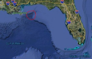
One of the first areas I wanted to examine was the large underwater “canyon” that lies about 80 miles SE of the point where the Mississippi/Alabama border touches the Gulf of Mexico. Please see the photo below for a map of the area I call Study #1. If you’d rather examine it yourself on Google Earth, the area is roughly defined by longitudes -87.6 on the left and -87.3 on the right and by latitudes 29.8 on the top and 28.1 on the bottom.

This rectangular area is approximately 76 miles wide by 117 miles high (8,892 square miles), which makes it a huge canyon indeed! The NGDC Web site provided me with more than a half-million data points for the area and each data point includes the longitude and latitude to six decimal places and the depth to the nearest 1/10th foot (1.2 inches).

The canyon area (aka Study #1) ranges in depth from 14.3 feet to 2,748.7 feet (after I threw out one anomalous point of 3,458.3 feet) which certainly puts portions of it above the surface 8,000 to 10,000 years ago! Could the “point” of the inverted “V” canyon be the site of an ancient port?

There are several other specific areas I want to examine in detail using the NGDC data and then I hope to begin a project of reconstructing the coastlines of the southern United States and the Florida Peninsula at various points in time, beginning 8,000 years ago and working backwards to the last glacial maximum, about 22, 000 years ago, when sea levels were at their lowest.

Please feel free to post any relevant data on this site or email it to rja (at) TheMegaBlog.com. Your input will be greatly appreciated and acknowledged!

Click to view larger image

Profile: William (Bill) Donato

Periodically I like to highlight individuals who are actively working to discover the truth about the ancient cultures of MegaAmerica – the Gulf and Caribbean basins of thousands of years ago.

William Michael Donato was recently featured in the SciFi Channel’s special called “Quest for Atlantis: Startling New Secrets” and he’s one of a growing number of archaeologists, anthropologists and other scientists who have broken with “mainstream” academia regarding the true nature of megalithic structures in the Caribbean. In fact, his Master’s thesis included photographs of underwater features he’d taken during his first expedition to Bimini in 1972.

Bill has been a speaker and often-quoted expert on Bimini Road and Atlantis theories for more than thirty years and he’s made a significant number of trips to the area to examine the evidence first-hand. His research has made extensive use of scuba dives, side-scan sonar, underwater video cameras and submarines to confirm his belief that the feature commonly know as “Bimini Road” is, in fact, a man-made breakwater built to protect an ancient harbor. The shape and construction methods at Bimini are identical to at least three similar – and equally ancient – breakwaters in the Mediterranean.

During a recent telephone conversation with Bill, he described preparations for yet another trip to the Bahamas, where he holds an archaeological research permit. The fall trip will be his third this year, having been there in February/March and again in June.

Bill is the founder and editor of The Atlantis Organization (T.A.O.), a scientifically oriented research and networking organization and newsletter focusing on archaeology and alternative theories & technologies. More recently, he formed the non-profit corporation A.P.E.X. Institute to investigate archaeological anomalies with a general focus on underwater sites.

A Bibliography of Articles by William Michael Donato

“Bimini and the Atlantis Controversy: What the Evidence Says”. The Ancient American, Vol. 1, No. 3, Nov/Dec 1993.

“What You Did Not See (or Hear) On Arthur C. Clarke’s Mysterious Universe”. The Ancient American, Vol. 3, No. 14.

“New Find At The Bimini Road”. The Ancient American, Vol. 3, No. 16.

“Bimini Granite Re-Classified – And It’s Still Out of Place!”. The Ancient American, Vol. 3, No. 17.

“Atlantis at Bimini: Fantasy or Fact?”. Bahamas Handbook and Businessman’s Annual 1999, Etienne Dupuch Jr. Publications,Nassau,Bahamas.

“Back to Bimini”. Atlantis Rising, Issue 14.

“Revisiting Edgar Cayce’s Caribbean Atlantis – Could New Discoveries Vindicate More Than Thirty Years of Intense Research?”. Atlantis Rising, Issue 30.

Cayce’s Fire Stone: Did the Sleeping Prophet Accurately Describe Maser and Lasers?”. Atlantis Rising, Issue 32.

“Atlantide Emerge a Bimini”. Hera #37.

Looking for MegaAmerica … the Search is on!

In my previous blog entry I suggested the term MegaAmerica to refer to the land and sea areas contained within the Caribbean and Gulf basins. I also suggested the term MegaAmericans to refer to the ancient maritime culture(s) that apparently sailed the waters of this region thousands of years before the arrival of the Spanish. This time I’d like to explain why I think this area – and its ancient inhabitants – should have a unique name on a par with the highly advanced cultures of Mexico and Central America.

Geologically, MegaAmerica is unique because it has changed so dramatically in the past 20,000 years. Most sources suggest that the water levels in the area have risen by as much as 125 meters (410 feet) during this time, with most of that change taking place between 20,000 years ago (the last glacial maximum) and about 8,000 years ago (the end of the last ice age). When the water levels were at their lowest, MegaAmerica looked much different than it does today. A great deal more land was exposed and the Caribbean and the Gulf of Mexico were much smaller – and more navigable with primitive canoes and rafts.

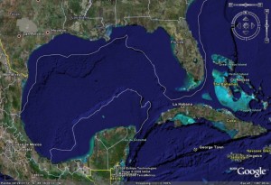
The original coastlines of MegaAmerica are now under water and many of them are miles off shore due to the very gradual sea floor slopes in much of the area. A quick glance at the Google Earth image below will give you some idea of how much different the world of the MegaAmericans was. It’s easy to look at the map and envision how much larger the land masses of MegaAmerica were back then. The trip from the Florida Peninsula to South America could have been made mostly by land, with only a few short canoe trips to cross the existing inlets. The Yucatan Peninsula may have touched the Florida Peninsula, transforming the Gulf of Mexico into a large inland lake!

Referring to the image again, imagine where the MegaAmericans would have built their major ports. For example, check out what appears to be a natural “harbor” north-northeast of Cancun. There’s a similar area about 70 miles due south of Pensacola, Florida. That’s where we should be searching for evidence and artifacts of this once-great maritime civilization!

As you study the image, or pan around the region using Google Earth, you’ll find many other sites that look promising. It also appears that in ancient times the shortest land portage from the Pacific to the Caribbean wasn’t in Panama, but was a few hundred miles west and north, in what is now Costa Rica. This is consistent with the theories of Ivar Zapp and George Erikson who suggest that the giant megalithic spheres of Costa Rica were actually used in the teaching of maritime navigation. Their book, Atlantis in America (ISBN 0-932813-52-6, Adventures Unlimited Press, 1998), is subtitled “Navigators of the Ancient World” and should be in the library of anyone who’s interested in what REALLY happened in ancient MegaAmerica!

Click to view larger image

MEGA Redefined

When I first started this blog, I was very interested in learning more about the reported discovery of an underwater megalithic site off the northwestern tip of Cuba. My objective was to trudge through the many articles, interviews and commentaries and piece together an up-to-date report on the discovery and the discoverers. During my trek, I’ve learned about other recent discoveries throughout the Caribbean that are almost as fascinating as the alleged “lost city of Cuba” so I’ve decided to broaden the scope of this blog. I’m also going to coin a new term to refer to my specific region of interest: MegaAmerica.

Click to view larger image

As opposed to Mesoamerica, which generally refers to the terrestrial region that extends roughly from the Tropic of Cancer in central Mexico down through northwestern Costa Rica[1], I’ll use MegaAmerica to refer to the Caribbean Sea, The Gulf of Mexico and all the lands they touch. For good measure, I’ll also throw in all the islands of the Bahamas and theLesser Antilles.

As with Mesoamerica, MegaAmericans will refer to civilizations that existed prior to the arrival of the Spanish, around 1500. This includes the Ciboney (or Siboney), the Taino (or Island Arawak) [see blog entry “Where Are the Artifacts?”] and any groups that preceded them. Specifically, I’ll focus on evidence for a maritime culture capable of building megalithic structures such as those found at Bimini, Andros and (possibly) the “lost city ofCuba” itself.

In blog entries that follow, I’ll examine in more detail the findings and theories of Greg & Lora Little, Bill Donato, George Erikson & Ivar Zapp, Angie Micol and others whose work supports the theory that an ancient maritime civilization once sailed the seas of the Americas. And, of course, I’ll continue to follow the developments of the original MEGA site, if (and when) credible information becomes available.

~~~~~~~

[1] Wikipedia, http://en.wikipedia.org/wiki/Mesoamerica

Sci Fi Channel Explores Bimini

On Friday, July 7, 2006 the Sci Fi Channel (http://www.scifi.com) premiered a special titled “Quest for Atlantis: Startling New Secrets.” The two-hour documentary, hosted by the Today Show’s Natalie Morales, spotlighted two independent (and competing) searches for the legendary city ofAtlantis – one in the Mediterranean and the other in theCaribbean.

Naturally, I was most interested in the Caribbean research and since watching the special I’ve spent hours hunting down additional information about the primary explorers, Drs. Greg and Lora Little.

The Littles have spent a significant amount of time trying to reestablish the site known as Bimini Road as a legitimate archeological site. Soon after its initial discovery in 1968, Bimini Roadwas declared a hoax by several geologists and serious investigation of the place screeched to a halt. As Greg Little says in the Sci Fi special, undertaking a serious exploration of Bimini “would probably ruin your reputation.” Undeterred, the Littles and several associates have made several recent dive trips to Bimini Road (May, 2005; February, 2006 and June, 2006) and they’ve made some amazing discoveries that seem to establish, once and for all, that Bimini Road is man-made and NOT a naturally occurring geological feature. They also believe that it’s not a road at all, but a breakwater that once enclosed an ancient harbor. Download Dr. Greg Little’s 29-page monograph here.

For years, geologists that wished to discredit the Bimini site claimed that the giant rectangular slabs of limestone had fractured in place and were lying on the sand where they had formed. In February, with an NBC camera crew present, Greg Little demonstrated that the blocks are carefully positioned on several layers of other rectangular stones and in some cases wedge shaped stones had been driven under edges of the slabs to hold them in position!

Additional work by the Littles at Andros Island (110 miles from Bimini) and Cay Sal (near Cuba, 250 miles from Bimini) indicate that the maritime culture that once existed in the area was expansive. When combined with this blog’s previously reported finds on both sides of Cuba, in the Florida Keys and at the MEGA site itself, it’s easy to imagine a vast network of ports and harbors that may have served the then inland cities of the Olmec or their predecessors.

Unfortunately, when important discoveries like the true nature of Bimini’s “road” are wrapped up in claims of “the discovery of Atlantis,” many professional and lay readers smile and immediately think “crackpot!” I don’t understand why simply discovering a new and ancient civilization isn’t satisfaction enough! Who cares if it’s Atlantis? Who cares if Atlantis even existed? Let’s get on with the science of discovery and the mythology will take care of itself.

“Quest for Atlantis” will air again on July 11th at 3:00 pm, July 13th at 11:00 pm and July 14th at 6:00 pm. All times are PST. You can also check out the show’s Web page at: http://www.scifi.com/questforatlantis/

Where are the artifacts?

In a recent communication with Michael Arbuthnot, leader of the underwater exploration group Team Atlantis (http://www.TeamAtlantis.com), I tried to convince him that he and his team should dive the recently discovered linear anomaly site off the Florida Keys and let us all know what’s really down there. While Mike didn’t rule out the trip, he did remind me of something that not only applies to the linear anomaly sites but to MEGA as well – where are the artifacts?

Mike accurately pointed out that if MEGA really exists,  ”then surely associated artifacts related to that site will be found onCuba.” This would be even more true if, as I suggested in an earlier blog entry,Cubawas at the center of a large network of cultural centers that also included the linear anomaly sites.

Mike summed up his perspective this way: “Without employing some standard by which to make judgements regarding the validity of controversial theories, ‘alternative’ ideas will always be viewed with healthy skepticism.”

Point well taken! My limited research into the ancient history of Cuba indicates that at least two pre-Columbian tribes inhabited the island – The Ciboney (or Siboney) and the Taino (or Island Arawak). Archeological records indicate that these groups may have been around for several thousand years before being mostly eradicated by the Spanish in the 1500s but both the Ciboney and the Taino were argrcultural cultures and there’s no evidence that they built any large structures, much less cities the likes of MEGA.

Spanish reporter Luis Mariano Fernandez claims (in http://www.s8int.com/water28.html) to have visited the home of geologist Manuel Iturralde and seen, first hand, images of MEGA recorded by a submarine camera. In that same article, Paulina Zelitsky is quoted as saying that scientists from the University of Veracruz (Mexico) have identified some of the symbols and inscriptions on the monoliths of MEGA as being Olmec in origin. If these pictures are ever made public, they may well provide proof that MEGA is really down there, but Mike Arbuthnot’s comments still leave us with the burning question – where are the artifacts?

Is MEGA just the tip of the iceberg?

Click to view larger image

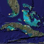
To the left is a graphic I put together from material I recently received from the good folks at Satellite Discoveries. It shows five newly discovered regions of linear patterns on the ocean floor. Four of these site are in Cuban waters and the fifth is off the tip of the Florida Keys. For more details and exact GPS coordinates, please visit the SD site at http://www.satellitediscoveries.com and scroll down to the New Additions section.

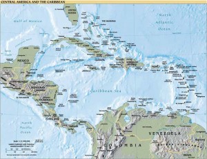
SD’s discoveries become even more fascinating when you view them in conjunction with the other item in the album, a relief map of the Caribbean. This map was taken from the CIA World Factbook (http://www.cia.gov/cia/publications/factbook/docs/refmaps.html) and it unintentionally provides a pretty good idea of what the Caribbean would have looked like 10,000 years ago, before the end of the last ice age. Graham Hancock (http://www.grahamhancock.com) and others believe that the oceans rose about 300 feet when the polar ice melted and that this event destroyed entire civilizations that had evolved in coastal areas. What’s interesting about the CIA map is that it puts all five of SD’s sites on dry land – either on an island, in a coastal area or, in the case of theFlorida site, well inland.

While the true nature of these linear patterns is not yet known, Satellite Discoveries has determined that the width of the lines in the photos is consistent with the width of roads! If they are roads, the underwater ruins known as MEGA may turn out to be just the tip of the iceberg (no pun intended) when it comes to Caribbean mysteries. Unfortunately, the Cuban sites are inaccessible to most of us, but the Florida site is only 90 to 110 feet deep and accessible with SCUBA gear. Who’s going to be the first to know what’s out there?


Profile: Manuel A. Iturralde Vinent

Dr. Iturralde is a senior researcher at the National Museum of Natural History inHavana,Cuba, and he’s been associated with MEGA since early 2002. He has very kindly provided us with detailed biographical information, which is used here with his permission.

Born in 1946 in the port city ofCienfuegos, on the Caribbean coast ofCuba, Iturralde received his geology degree in 1975 from the Universidad de Oriente (University of the West) inSantiago,Cuba. He earned a Ph.D. in 1995 and he lists his specialties as geology and paleontology of theCaribbean, environmental geology, karstology (the study of limestone caves) and plate tectonics. He has received a long list of awards, including the Juan Tomás Roig Medal for more than 40 years of scientific research. Suffice it to say that he’s a highly respected scientist who’s opinions and analysis regarding MEGA make the discovery that much more significant.

Iturralde has worked with Paulina Zelitsky and Paul Weinzweig, of ADC, to help determine whether the images captured by the ADC crew are of an ancient city or simply a naturally occurring rock formation. In [1], Iturralde is quoted as saying, “It turns out to be, to me, very complicated to explain this from a geological point of view.” On the subject of whether or not MEGA is the site of streets and pyramids, as reported by the media, Iturralde objectively observes that, “As a geologist I can say that there are high linear structures that could perfectly agree with streets and pyramids.”

Dr. Iturralde has prepared a report summarizing several working theories about the origin of MEGA, which I’ll cover in detail in a later blog entry, but the report’s conclusion is that “the megalithic structures are not associated with faults, fractures or breaks on the slope. Therefore, its origin is yet to be understood.”

[1] Fernandez, Luis Mariano, as reported on http://www.s8int.com/water28.html